


Cleveland County--Norman, Oklahoma City (South) & Moore Cities PUMA, Oklahoma
About
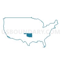
Outline
+%26+Moore+Cities+PUMA%2c+Oklahoma_A280.png)
Summary
| Unique Area Identifier | 193796 |
| Name | Cleveland County--Norman, Oklahoma City (South) & Moore Cities PUMA |
| State | Oklahoma |
| Area (square miles) | 558.09 |
| Land Area (square miles) | 538.77 |
| Water Area (square miles) | 19.32 |
| % of Land Area | 96.54 |
| % of Water Area | 3.46 |
| Latitude of the Internal Point | 35.20311670 |
| Longtitude of the Internal Point | -97.32833180 |
Maps
+%26+Moore+Cities+PUMA in Oklahoma.png)
Graphs
Select a template below for downloading or customizing gragh for Cleveland County--Norman, Oklahoma City (South) & Moore Cities PUMA, Oklahoma
+%26+Moore+Cities+PUMA%2c+Oklahoma_T0.png)
+%26+Moore+Cities+PUMA%2c+Oklahoma_T1.png)
+%26+Moore+Cities+PUMA%2c+Oklahoma_T2.png)
+%26+Moore+Cities+PUMA%2c+Oklahoma_T3.png)
+%26+Moore+Cities+PUMA%2c+Oklahoma_T4.png)
+%26+Moore+Cities+PUMA%2c+Oklahoma_T5.png)
+%26+Moore+Cities+PUMA%2c+Oklahoma_T6.png)
+%26+Moore+Cities+PUMA%2c+Oklahoma_T7.png)
+%26+Moore+Cities+PUMA%2c+Oklahoma.png)
Neighbors
Neighoring Public Use Microdata Area (by Name) Neighboring Public Use Microdata Area on the Map
- Canadian County--Oklahoma City (West) PUMA, OK
- Grady, McClain & Pottawatomie (South) Counties PUMA, OK
- Oklahoma County (Southeast)--Oklahoma City (East Central) PUMA, OK
- Oklahoma County (Southwest)--Oklahoma City (West Central) PUMA, OK
- Pottawatomie (North), Logan & Lincoln Counties--Shawnee City PUMA, OK
Top 10 Neighboring County (by Population) Neighboring County on the Map
- Oklahoma County, OK (718,633)
- Cleveland County, OK (255,755)
- Canadian County, OK (115,541)
- Pottawatomie County, OK (69,442)
- McClain County, OK (34,506)
Top 10 Neighboring County Subdivision (by Population) Neighboring County Subdivision on the Map
- Oklahoma City Southwest CCD, Oklahoma County, OK (429,392)
- Oklahoma City Southeast CCD, Oklahoma County, OK (145,193)
- North Cleveland CCD, Cleveland County, OK (121,027)
- Norman CCD, Cleveland County, OK (102,464)
- East Canadian CCD, Canadian County, OK (86,541)
- Shawnee CCD, Pottawatomie County, OK (64,590)
- East Cleveland CCD, Cleveland County, OK (22,860)
- Purcell CCD, McClain County, OK (17,169)
- Newcastle-Blanchard CCD, McClain County, OK (15,994)
- Noble CCD, Cleveland County, OK (6,720)
Top 10 Neighboring Place (by Population) Neighboring Place on the Map
- Oklahoma City city, OK (579,999)
- Norman city, OK (110,925)
- Moore city, OK (55,081)
- Mustang city, OK (17,395)
- Newcastle city, OK (7,685)
- Noble city, OK (6,481)
- Purcell city, OK (5,884)
- Slaughterville town, OK (4,137)
- McLoud town, OK (4,044)
- Bethel Acres town, OK (2,895)
Top 10 Neighboring Elementary School District (by Population) Neighboring Elementary School District on the Map
Top 10 Neighboring Unified School District (by Population) Neighboring Unified School District on the Map
- Moore Public Schools, OK (125,679)
- Norman Public Schools, OK (107,263)
- Midwest City-Del City Schools, OK (77,695)
- Mustang Public Schools, OK (46,023)
- Noble Public Schools, OK (15,793)
- Harrah Public Schools, OK (11,152)
- McLoud Public Schools, OK (10,691)
- Tecumseh Public Schools, OK (9,799)
- Lexington Public Schools, OK (8,240)
- Newcastle Public Schools, OK (7,888)
Top 10 Neighboring State Legislative District Lower Chamber (by Population) Neighboring State Legislative District Lower Chamber on the Map
- State House District 53, OK (48,374)
- State House District 43, OK (44,484)
- State House District 91, OK (44,349)
- State House District 46, OK (44,285)
- State House District 45, OK (43,435)
- State House District 47, OK (41,973)
- State House District 96, OK (41,721)
- State House District 54, OK (39,563)
- State House District 101, OK (37,753)
- State House District 42, OK (37,553)
Top 10 Neighboring State Legislative District Upper Chamber (by Population) Neighboring State Legislative District Upper Chamber on the Map
- State Senate District 24, OK (98,936)
- State Senate District 15, OK (87,049)
- State Senate District 45, OK (85,350)
- State Senate District 44, OK (79,225)
- State Senate District 16, OK (78,677)
- State Senate District 43, OK (78,345)
- State Senate District 42, OK (76,564)
- State Senate District 28, OK (76,209)
- State Senate District 17, OK (74,685)
Top 10 Neighboring 111th Congressional District (by Population) Neighboring 111th Congressional District on the Map
Top 10 Neighboring Census Tract (by Population) Neighboring Census Tract on the Map
- Census Tract 4001.02, McClain County, OK (9,323)
- Census Tract 5010.01, Pottawatomie County, OK (8,391)
- Census Tract 4002.02, McClain County, OK (7,996)
- Census Tract 5011.02, Pottawatomie County, OK (7,907)
- Census Tract 2013.01, Cleveland County, OK (7,499)
- Census Tract 2024.05, Cleveland County, OK (7,006)
- Census Tract 2025, Cleveland County, OK (6,720)
- Census Tract 4001.01, McClain County, OK (6,671)
- Census Tract 2015.10, Cleveland County, OK (6,640)
- Census Tract 2008, Cleveland County, OK (6,574)
Top 10 Neighboring 5-Digit ZIP Code Tabulation Area (by Population) Neighboring 5-Digit ZIP Code Tabulation Area on the Map
- 73160, OK (53,666)
- 73072, OK (42,797)
- 73071, OK (36,711)
- 73170, OK (35,343)
- 73159, OK (30,350)
- 73069, OK (23,912)
- 73020, OK (20,810)
- 73064, OK (20,611)
- 73135, OK (20,529)
- 73139, OK (17,253)